
Global Climate Patterns by Atlas Guo
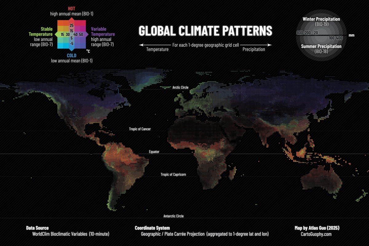
MEDIUM: Map, Data Visualization, Poster
DESCRIPTION:
Global Climate Patterns is a multivariate map of global climate based on WorldClim bioclimatic variables. Using a one-geographic-degree grid in a Plate Carrée projection, it combines annual mean temperature and annual temperature range with precipitation of the hottest quarter and precipitation of the coldest quarter. Temperature is encoded through color, while precipitation is shown by paired semicircles whose sizes indicate seasonal precipitation. Together, these symbols present broad climatic structure and spatiotemporal variation across the world’s land areas.
ARTIST’S STATEMENT:
I created this map to explore how multiple climatic variables could be shown clearly within a single global reference image. My goal was to keep temperature and precipitation visually distinct while still allowing them to be read together as part of a coherent climate pattern. By using color for long-term thermal characteristics and symbol size for seasonal precipitation, I wanted the map to function as both a detailed visual reference and an accessible overview for students, researchers, and general audiences interested in global climate.
View this Map