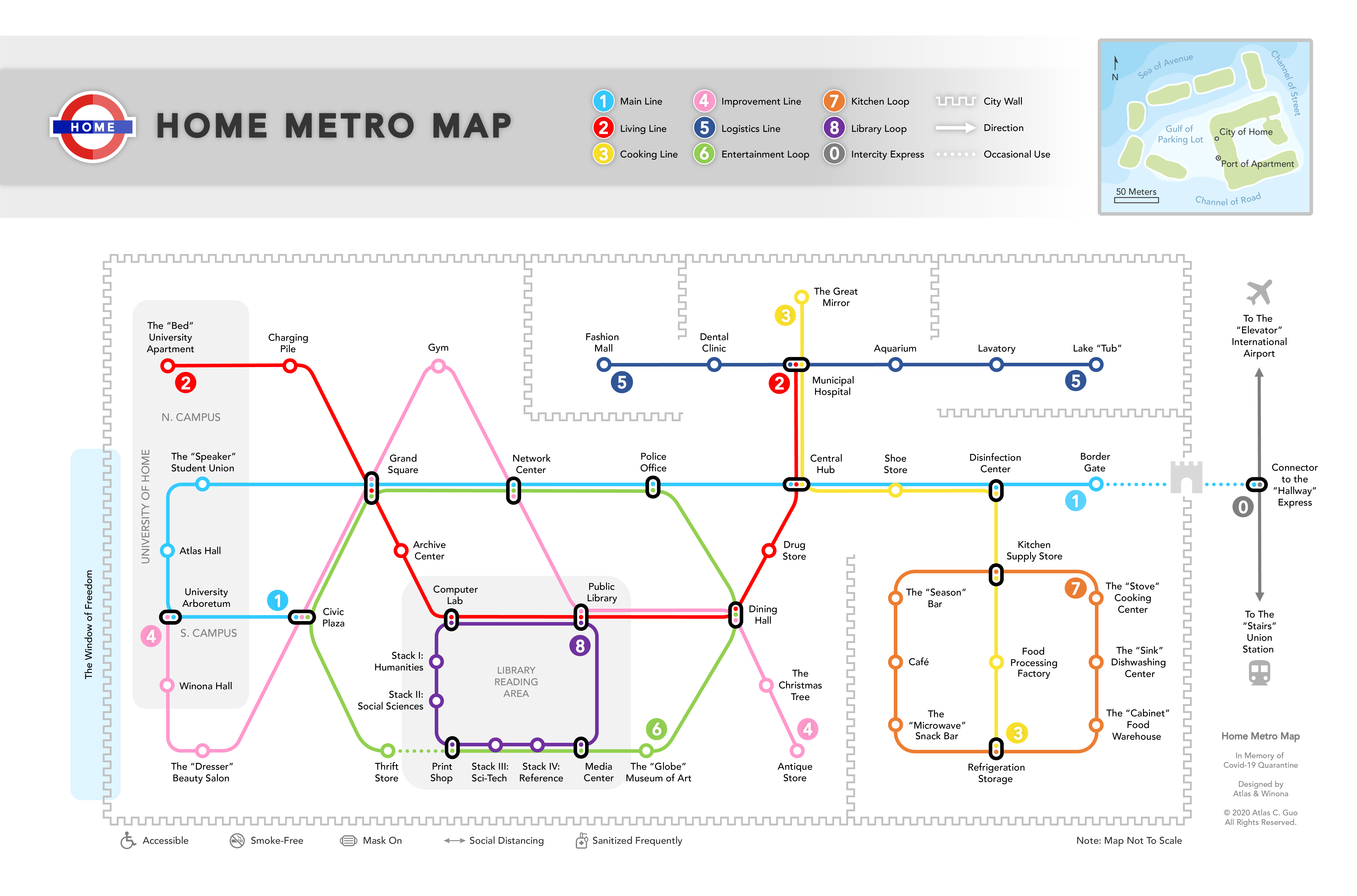
Home Metro Map by Atlas Guo
MEDIUM: Digital Image / Map
DESCRIPTION:
This made-up map is designed in memory of the quarantine period for the COVID-19 pandemic in 2020, during which my wife and I seldom went outdoors and spent most of our time staying at home. Inspired by the metro transit maps, we created this product displaying the major areas, furniture, and appliances in my rectangular apartment unit, connected by several fictitious metro lines. Considering the geographic scale, the entire unit is regarded as an imaginary city, based on which many details are designed: the metro stations are named as individual places within a city; the order of the metro lines follows the progress of urban development; and the fixed boundary of the city wall reflects the geographical barriers. Also, a locator map is made to provide broader geographic information, with designs turning the whole apartment building into an island country, with real land as marine areas. Besides the laughter, we also hope this hilarious map could further raise some educational reminders of the significance of practices to stay healthy and fight against the pandemic scientifically, such as wearing face masks, practicing social distancing, and using sanitizer.
ARTIST’S STATEMENT:
Atlas Guo is a doctoral student in UW–Madison’s Department of Geography and has a broad interest in cartographic design. (More info: https://cartoguophy.com/)